

The alarm went off at 4:45am to get us up in time to catch the 6:30am dawn at Peggy’s Cove, just over an hour drive away. We packed up the dew-drenched tent using light from our headlamps and drove down to the “comfort station†for a quick shower before getting on the road. We didn’t have time for breakfast or to make a brew, so we swept through a Tim Horton’s drive-through and grabbed a double-double (double cream, double sugar) and a small black coffee.
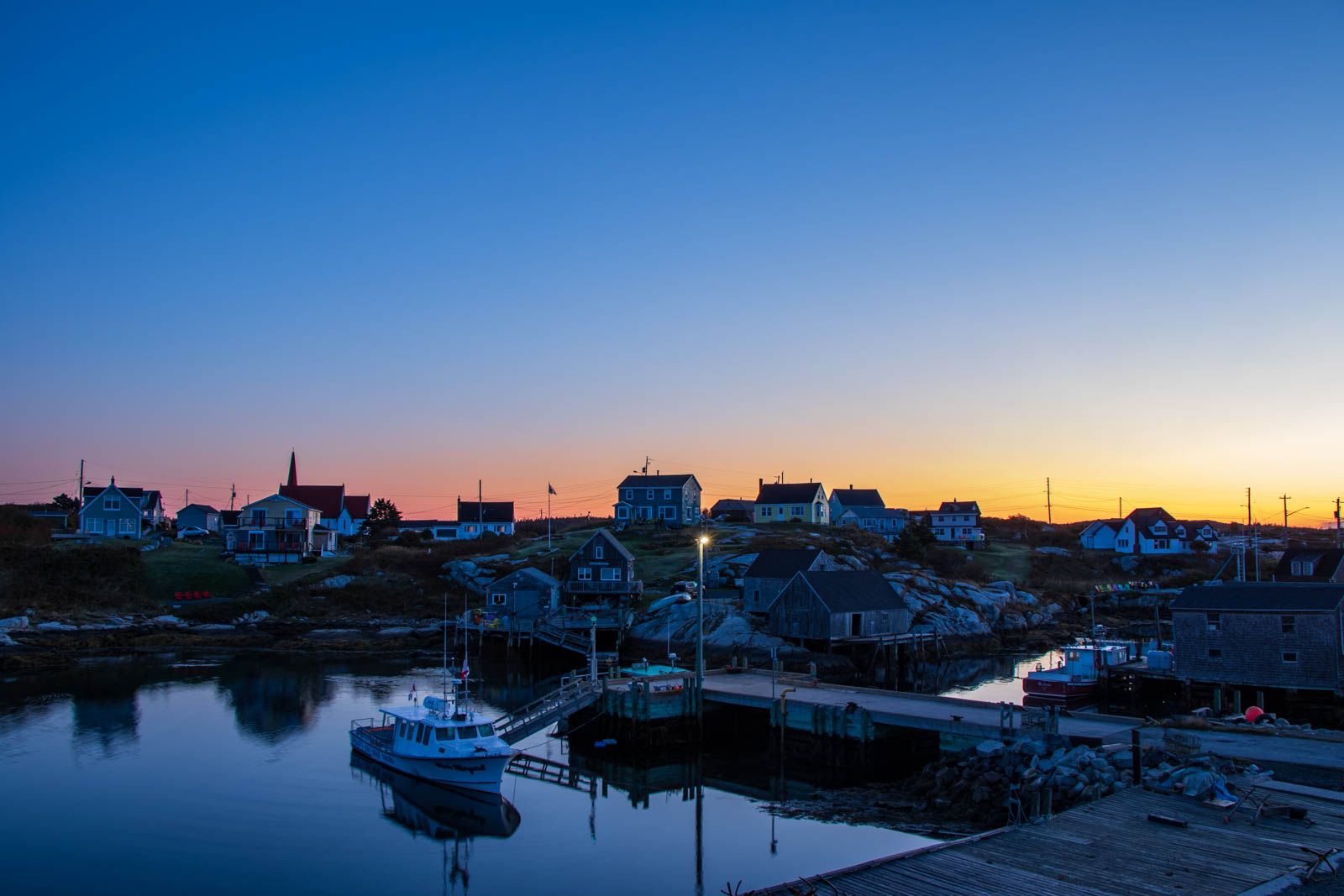
The road to Peggy’s Cove was nerve wracking, as for several kms through a windy forested section the road had no markings, and we kept getting blinded by huge Ford F250s and Dodge Rams with their high-beams on. Once we passed the final turn-off the road quietened down and eventually opened up into a tundra-like landscape. We drove through the little sleeping town of Peggy’s Cove and parked in the main carpark (the town is of course a major tourist destination) just before sunrise.
The car told us that it was 1 degree C outside, so we got all bundled up with jackets and toques and headed out to climb the rocks along the shoreline. At the beginning of the path from the carpark we saw a sign warning us about black ice on the rocks and of the danger of unexpected waves. I was disappointed that they didn’t call them ‘sneaker waves’ like they did in Iceland.
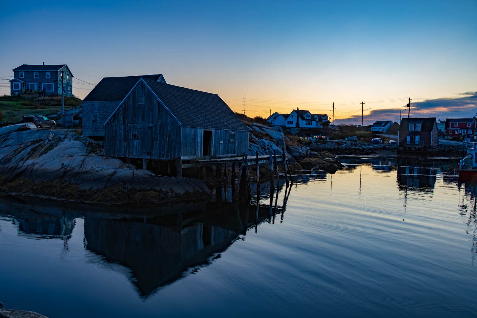
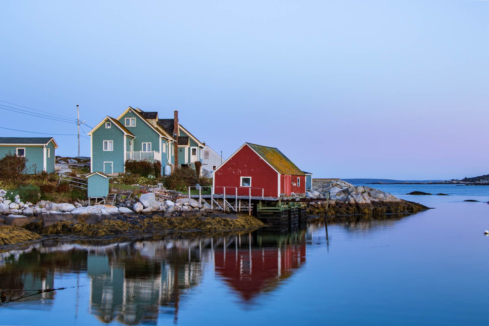
Peggy’s Cove is a rural fishing village that was founded in 1811. It consists of a small number of wooden buildings, perched precariously on the 415-million-year-old granite that had been scraped bare of vegetation by a glacier 20,000 years ago. While the community still engages in commercial fishing (mainly lobster), tourism has been the principle industry since the Second World War. There has been a preservation area in force since 1962 covering 8.1 square kilometres around Peggy’s Cove, which prohibits new development in and around the village, and heavily restricts modifications to existing buildings.
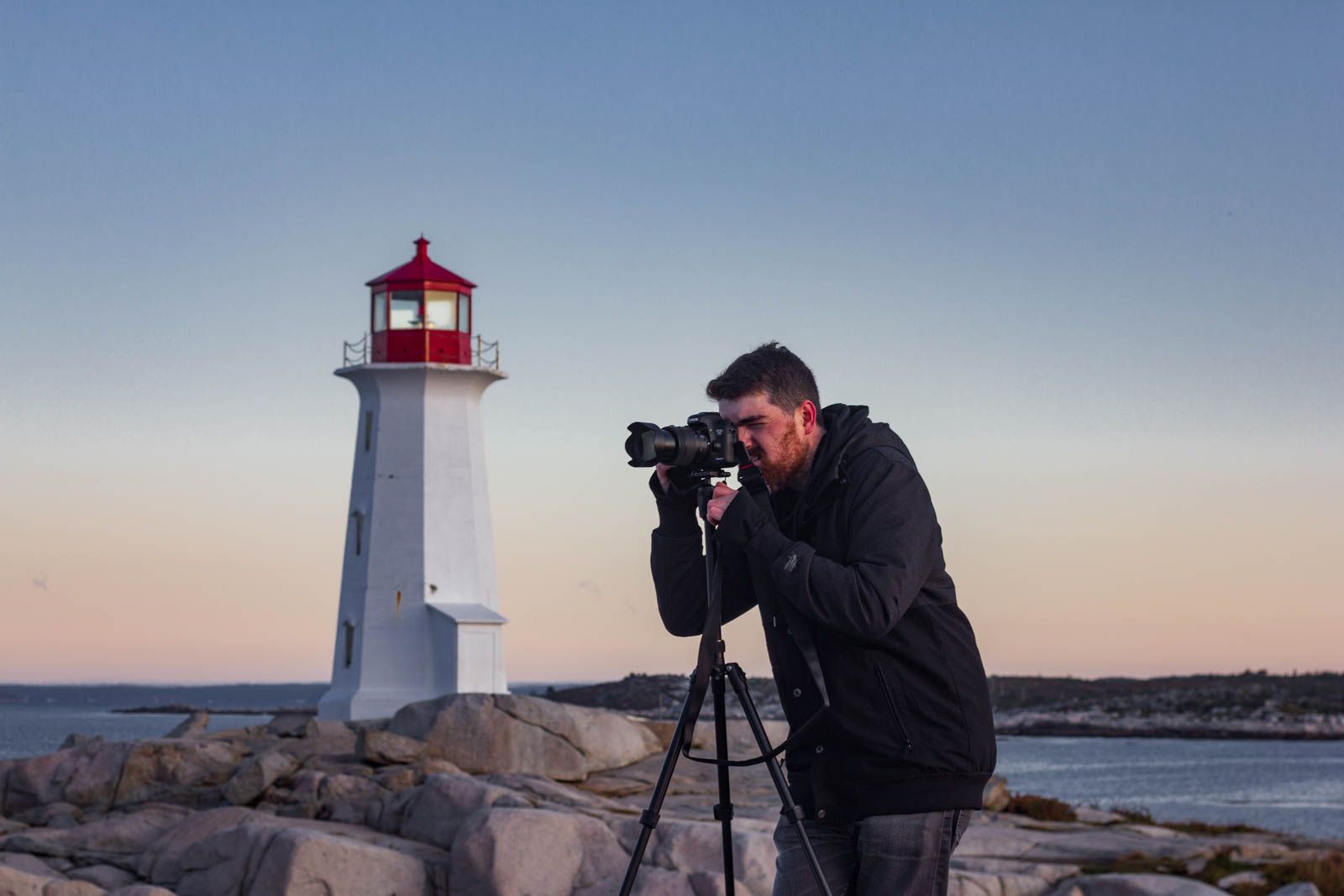
We walked around taking photos of everything we could think of, from all different angles, and revisiting spots as the sun climbed higher and higher in the sky. Katie has a fast 50mm lens on her camera so could easily take handheld shots, but I was using a wider-angle lens which was much slower and therefore needed a tripod. I took advantage of having the tripod out to take some bracketed exposures, which is where the camera takes three photos of different exposures in quick succession, and you combine them later on in Adobe Lightroom. This lets you recover more detail from the dark parts of the image, while retaining the beautiful colours in the sky. If you push the settings too far though, it results in tacky looking “HDR†images (I'm still working on this).
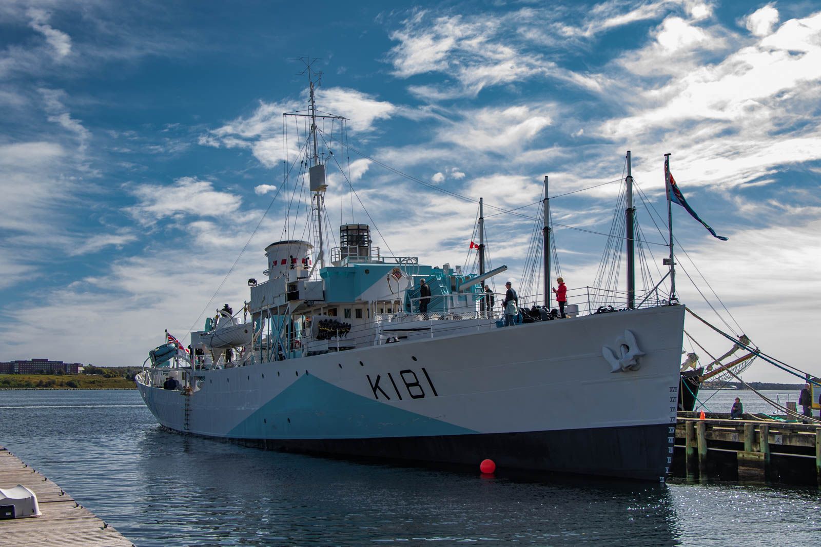
After running out of things to take pictures of, we climbed back into the car and headed for a diner in Halifax, the capital of Nova Scotia. Once the food and coffee had kicked in and we’d woken up again, we headed down to the waterfront where we walked along a beautiful boardwalk for an hour. We stopped to look at some displays set out by the Halifax Maritime Museum, which told some stories about the Halifax Explosion.
The Halifax Explosion was an accidental detonation of a French cargo ship (the SS Mont-Blanc) which was laden with high-explosive munitions, after a Norwegian vessel (the SS Imo) collided with it in the upper harbour. The resulting explosion demolished entire neighbourhoods and killed at least 2000 people. The blast was the largest man-made explosion at the time and is still the third largest conventional (non-nuclear) explosion.
Back in the car again, we drove on to another quaint seaside village called Mahone Bay. Mahone Bay was very manicured with lots of brightly coloured retail buildings and nice houses, and a few churches with very tall steeples. Most of the shops were art, gift, and antique stores scattered in amongst the craft breweries, cafes, and restaurants to fuel the tourist crowds. We stopped in at Saltbox Brewery and tried two unremarkable beers, and sat on their patio for half an hour to make use of their Wi-Fi and look through the photos we’d taken earlier in the day.
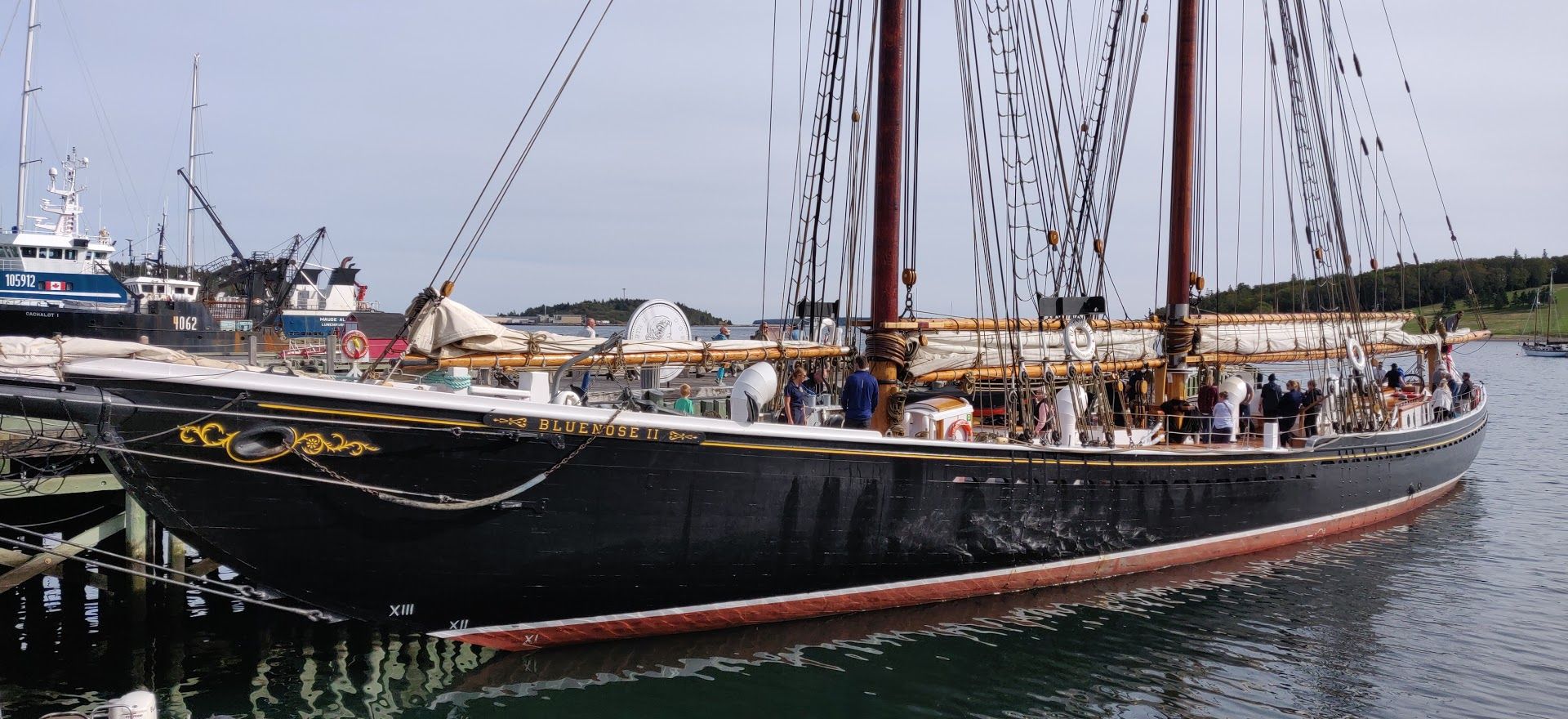
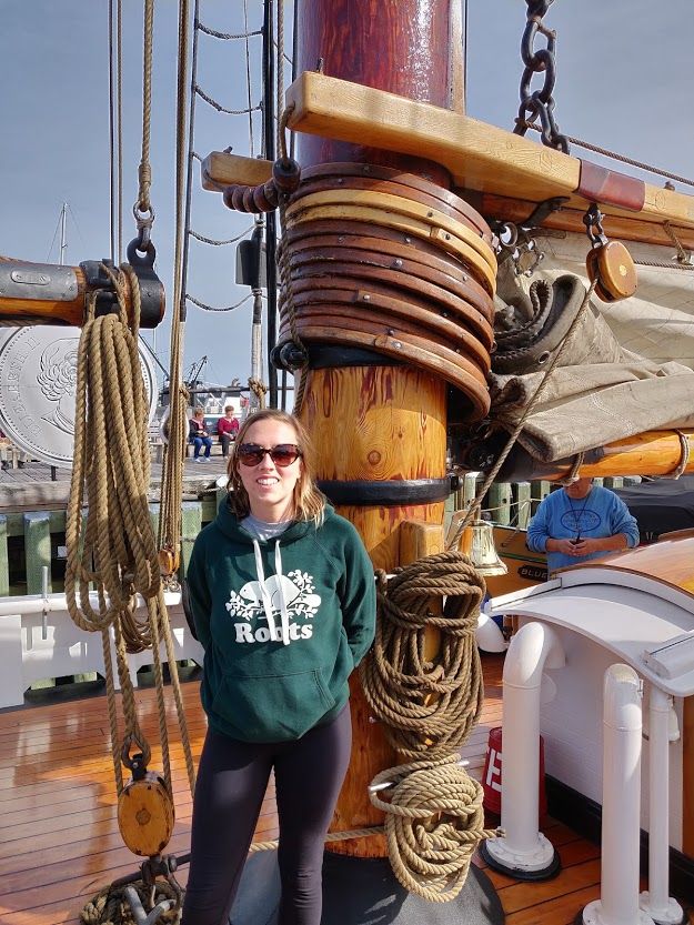
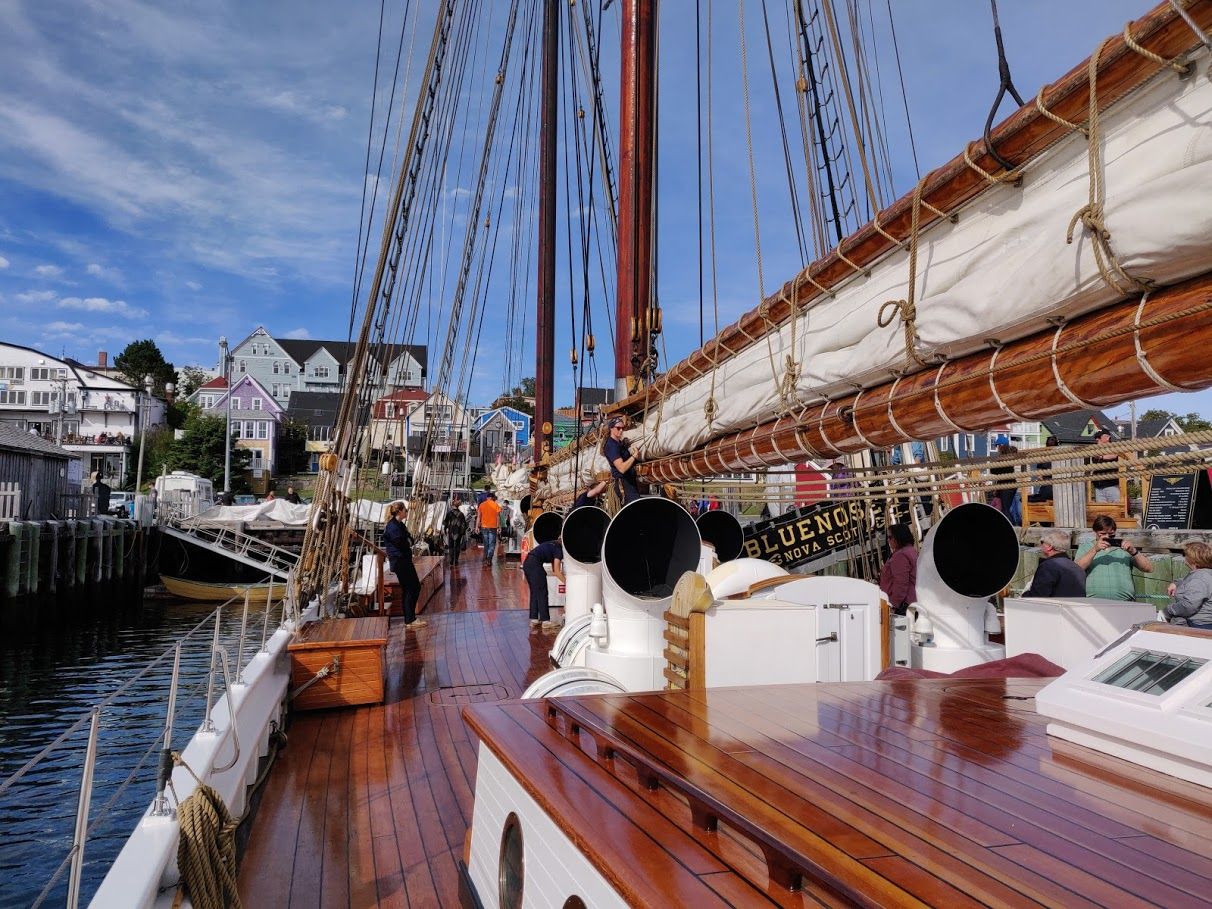
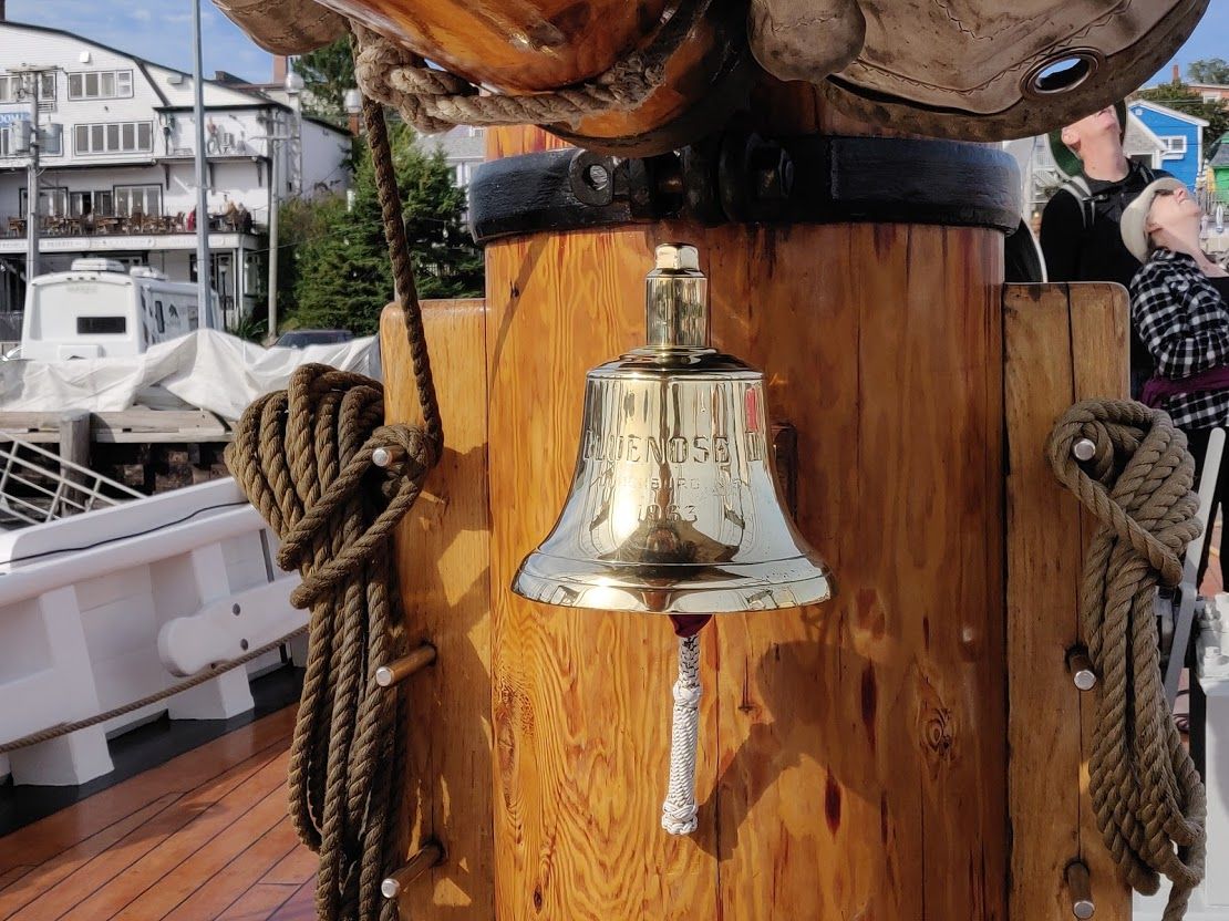
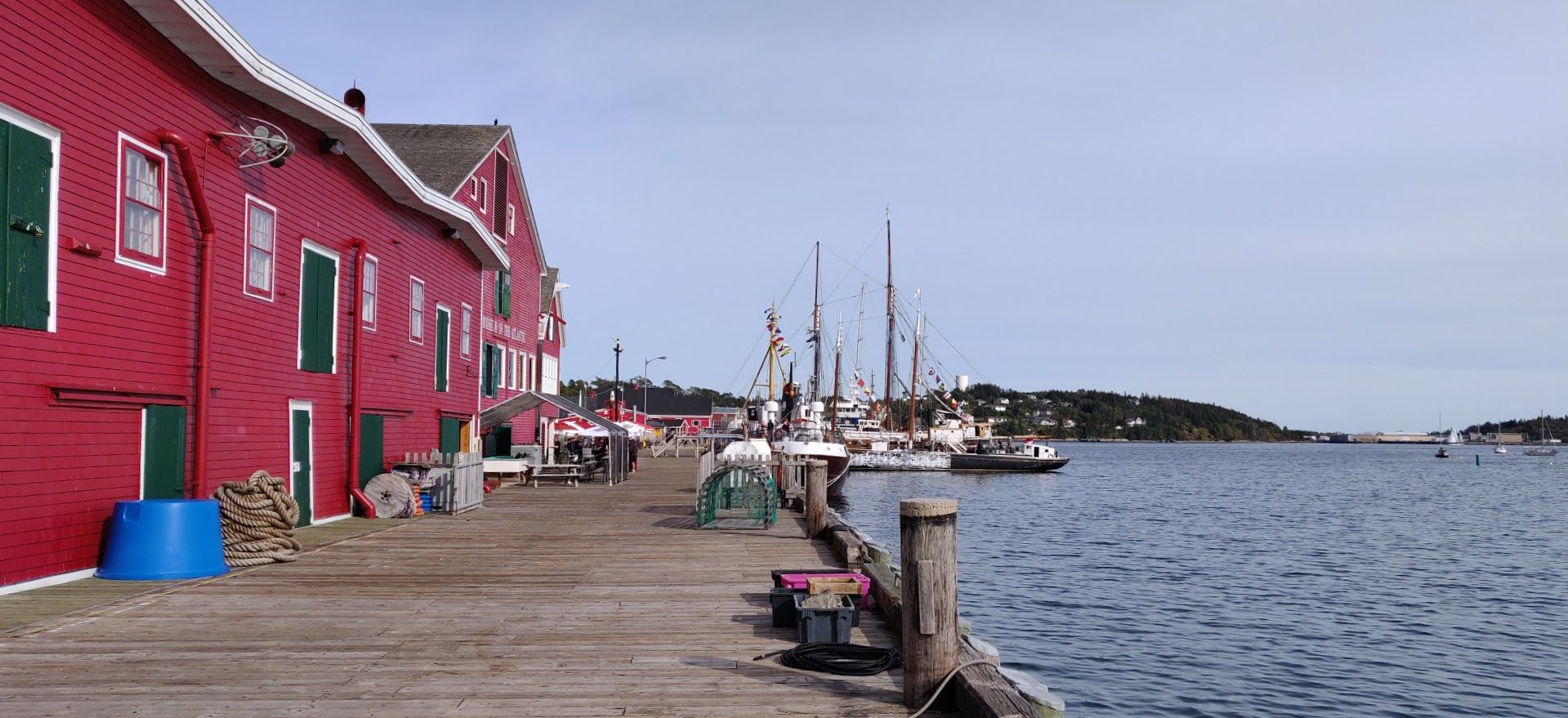
Our final town today was Lunenburg, a port town and home to the schooner Bluenose II. This schooner, built in 1963 as a replica of Bluenose, a fishing schooner also built in Lunenburg in 1921, is a sail training ship owned by the province of Nova Scotia. It is the provincial symbol of Nova Scotia, and not only appears in the centre of all their vehicle number plates, but also features on the Canadian 10c coin. I had been aboard when the ship visited Toronto as part of a North American tall ship tour, but Katie hadn’t come with me so I was happy to climb down the gangplank again with her. We marveled at the incredible polish that everything had, and at the mast and spars made of single Douglas fir trunks.
We ate lunch at a deli overlooking the harbour and had our second ever lobster roll. This one seemed much higher quality than the tourist-trap version we’d tried in St John, New Brunswick, and instead of being stuffed with shredded meat this one had discernible pieces of lobster claw in it. Lobster meat doesn’t seem to have a very strong flavour, so it relies on what the sandwich is dressed with to make it delicious. The first roll we tried had butter and lemon juice as dressing, but this one had a tarragon mayo and romaine lettuce to provide some nice contrasting crunchy texture.
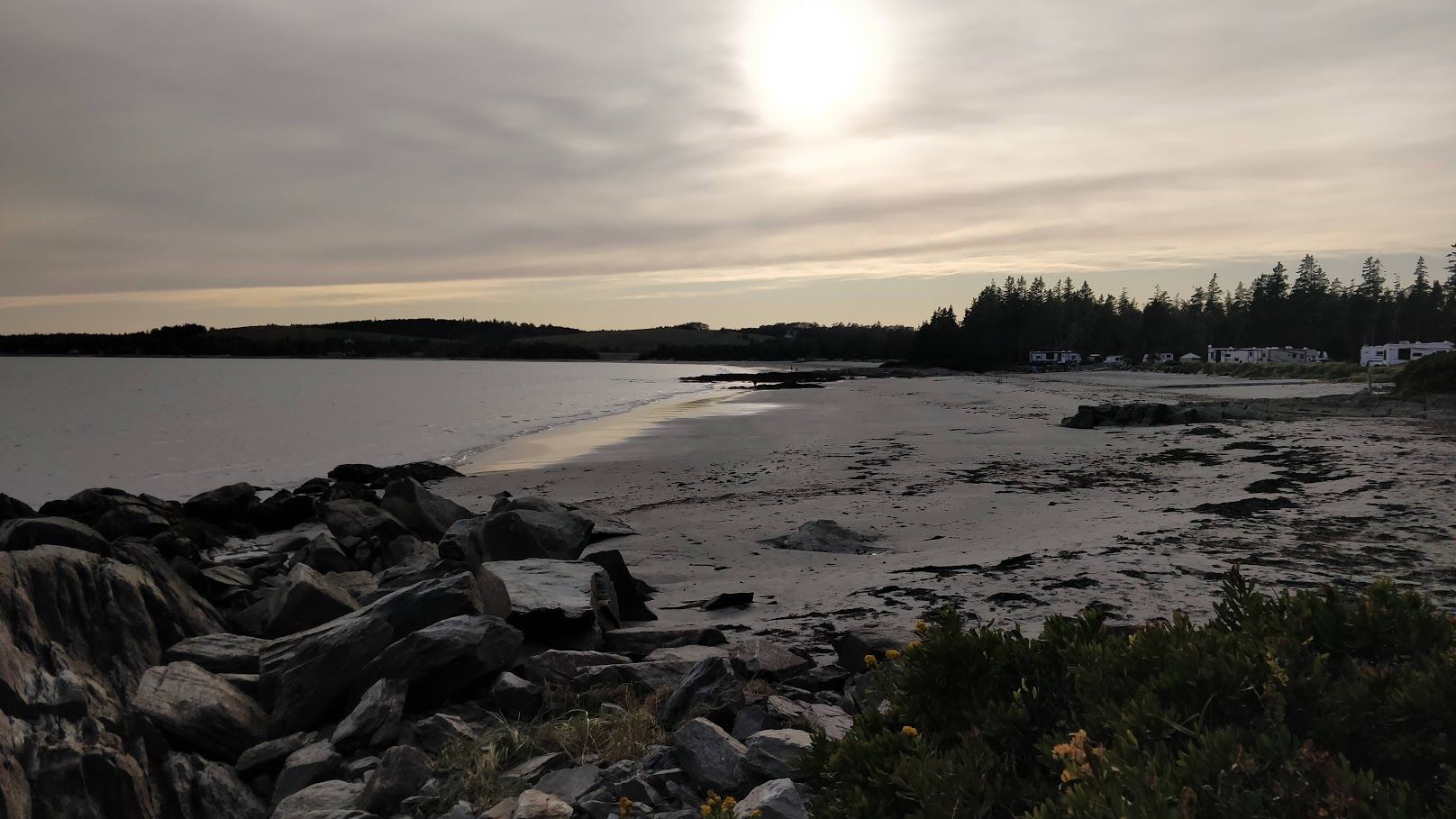
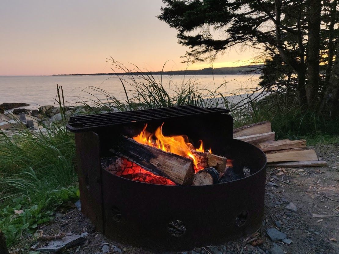
We’re now at a water-front campsite in a small place called Risser’s Beach, sitting around a warm campfire and listening to the waves crash onto the shore 10 metres away.