

Norris Geyser Basin
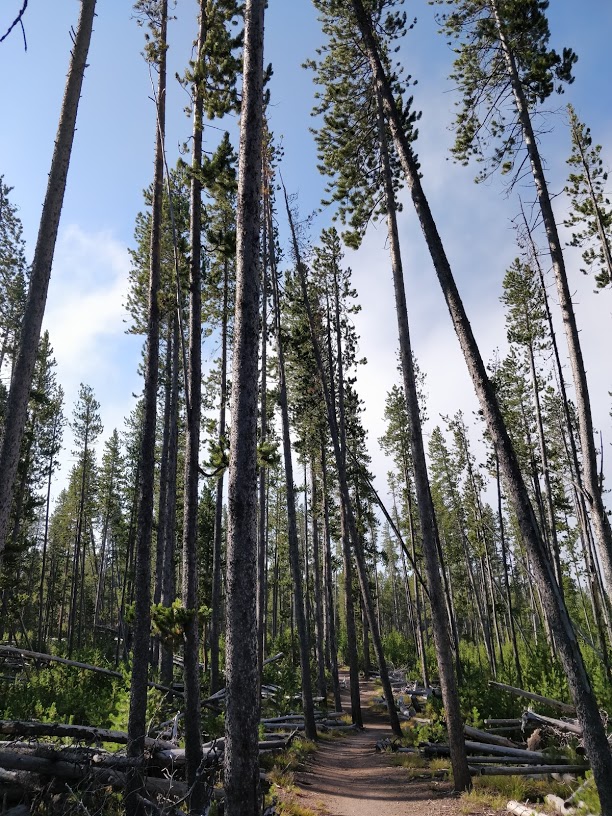
Norris' carpark is particularly notorious for being small and crowded with tourists. To avoid the mayhem, we walked from our campsite for about 30 minutes to the Norris Geyser Basin. The trail led us across a meadow, over a stream and through a dense lodgepole pine forest. We had previously heard a ranger joke that the Latin name for these endless trees is Pinus Monotonous - hehe! The high elevation (approx 2,400m) and volcanic, rhyolitic soils mean that lodgepole pine thrive here and dominate 80% of the forest in the park.
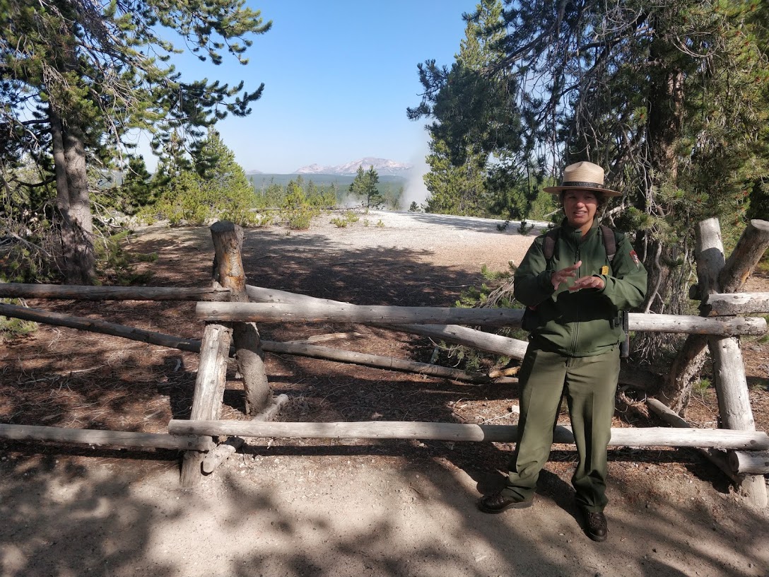
We arrived at the ranger station just in time for a ranger-led tour of the basin. Laura, the park ranger, had spoken at our campsite a few nights earlier about microbiology in the area, so we were keen to tour the basin with her as our guide.
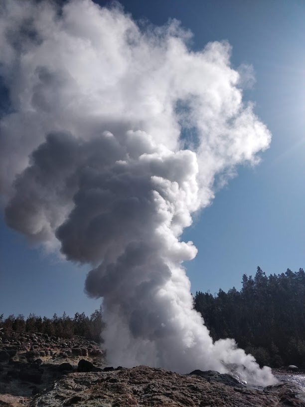
Steamboat Geyser is the largest active geyser in the world! Only Waimangu Geyser in New Zealand has reached greater heights — but hasn't in more than one hundred years. Steamboat Geyser is super unpredictable, and no one is sure of when or for how long it will erupt. When it eventually does, it reaches heights of 91m and covers the cars in the carpark with silica-laden water! Apparently, the silica sticks to everything and is almost impossible to get off. When we visited, plumes of steam were spilling out of geyser - which was apparently quite unusual.
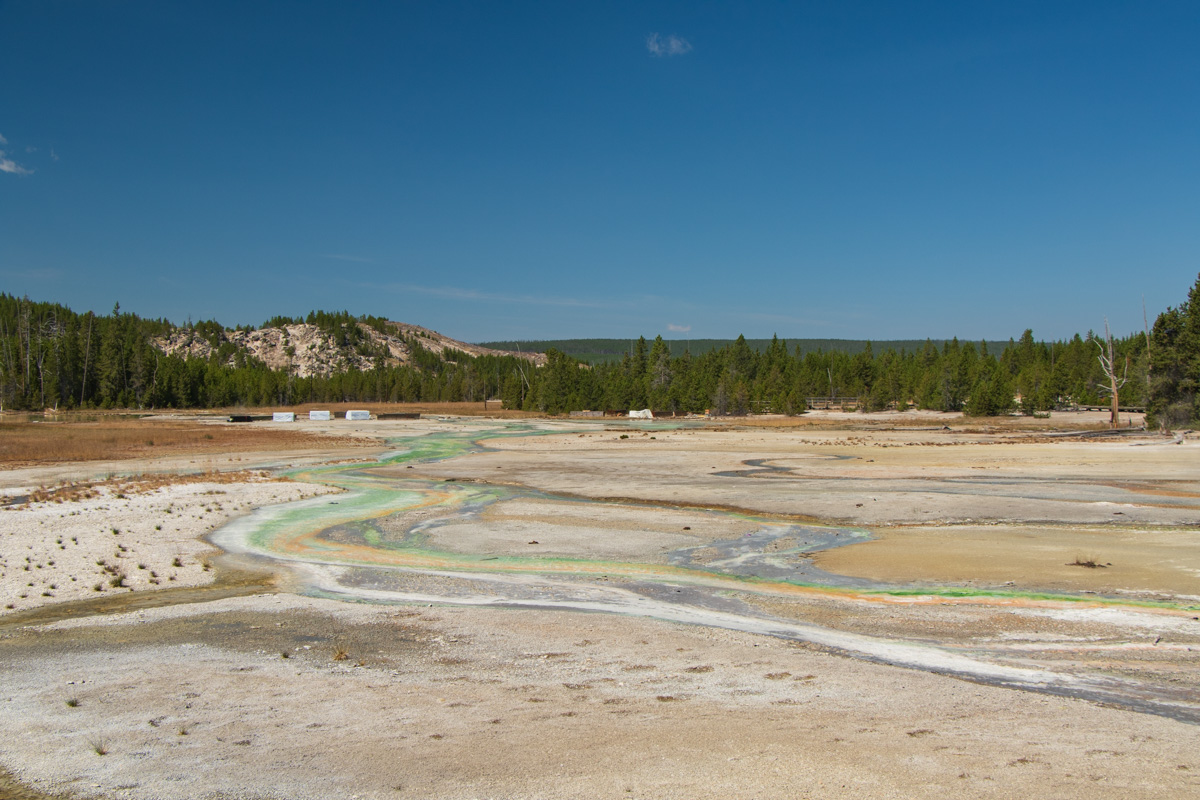
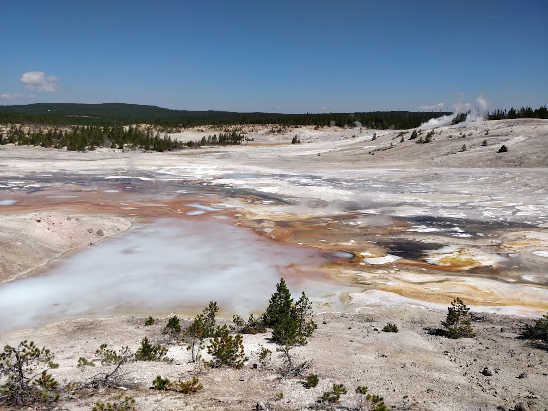
Norris is located on the intersection of three major faults on the edge of the Yellowstone Caldera. This basin is unique in that the water from the springs is acidic (about the same pH as vinegar), providing the perfect environment for acidothermophilic bacteria (acid- and heat-loving organisms) to live. As a result, Norris has different coloured springs, pools and streams to the rest of Yellowstone!
Porcelain Basin
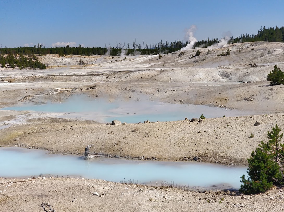
Features in this area change almost daily, due to seismic activity and water level fluctuations. Springs are continually popping up, drying out or suddenly turning into geysers. As a result, boardwalks are raised off the ground, with the supporting posts sitting on the surface of the ground (as opposed to being sunk in) so that they can easily shift with the changing geology.
Roaring Mountain
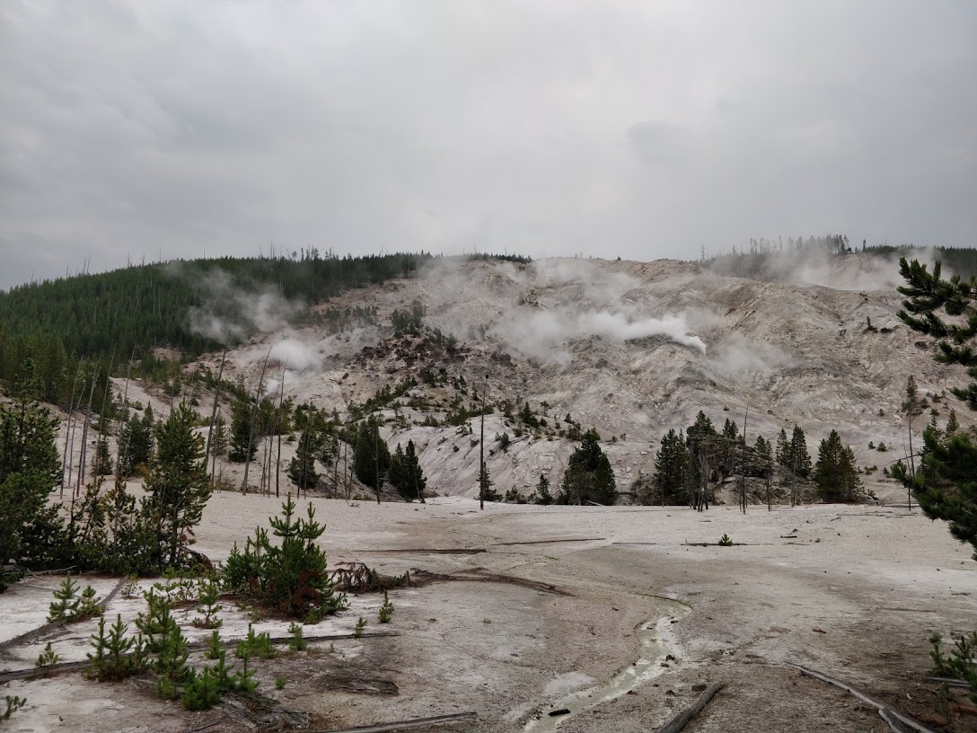
Roading Mountain takes its name from the hissing, bubbling fumaroles (holes in the ground which emit steam and gases). Although much calmer today, apparently in the 1900's it could be heard from several miles away.
Right on the side of the road, heading out of Norris, we passed Roaring Mountain several times during our stay. Sometimes it looked like a jagged, rocky hillside, and at other times you could barely see it - there was so much steam coming from it!
After a morning spent close to home, we decided to take a drive in the afternoon to explore the northeast region of the park, known for its greater variety of vegetation and prominent wildlife. While we were heading for the Lamar Valley, we found plenty of places to stop along the way. We found that this was pretty typical for Yellowstone, as there is just so much to see!
Mount Washburn
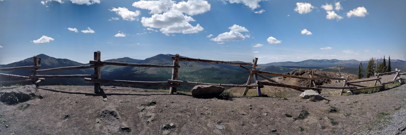
Mt Washburn is a prominent mountain peak in the Yellowstone Park and sits at 3,122m in elevation. The trails on the mountain were closed for restoration - but the drive through the mountain range had some spectacular views and delicate, colourful wildflowers on the sides of the road.
Tower-Roosevelt Area
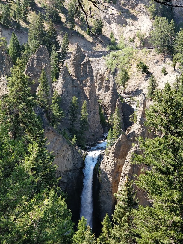
Tower Fall is a beautiful waterfall named after the rock pinnacles or towers at the top of the fall.
Although most people seemed to be visiting solely to see the waterfall, Sean and I were more impressed with the rock face across the Yellowstone River! You could clearly see where basalt lava flow had formed layers of hexagonal basalt columns (like at Sheepeater Cliff). The Yellowstone River had carved out a vast river valley, revealing these layers in the cliff face.
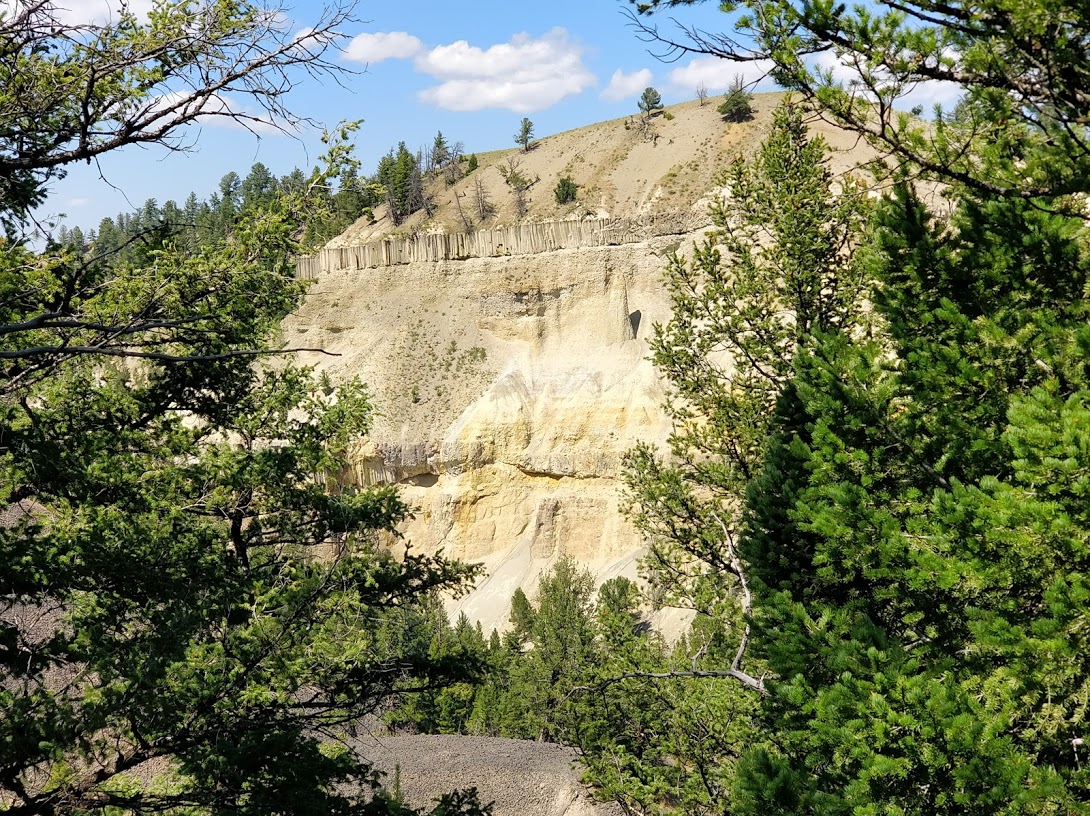
Calcite Springs Overlook
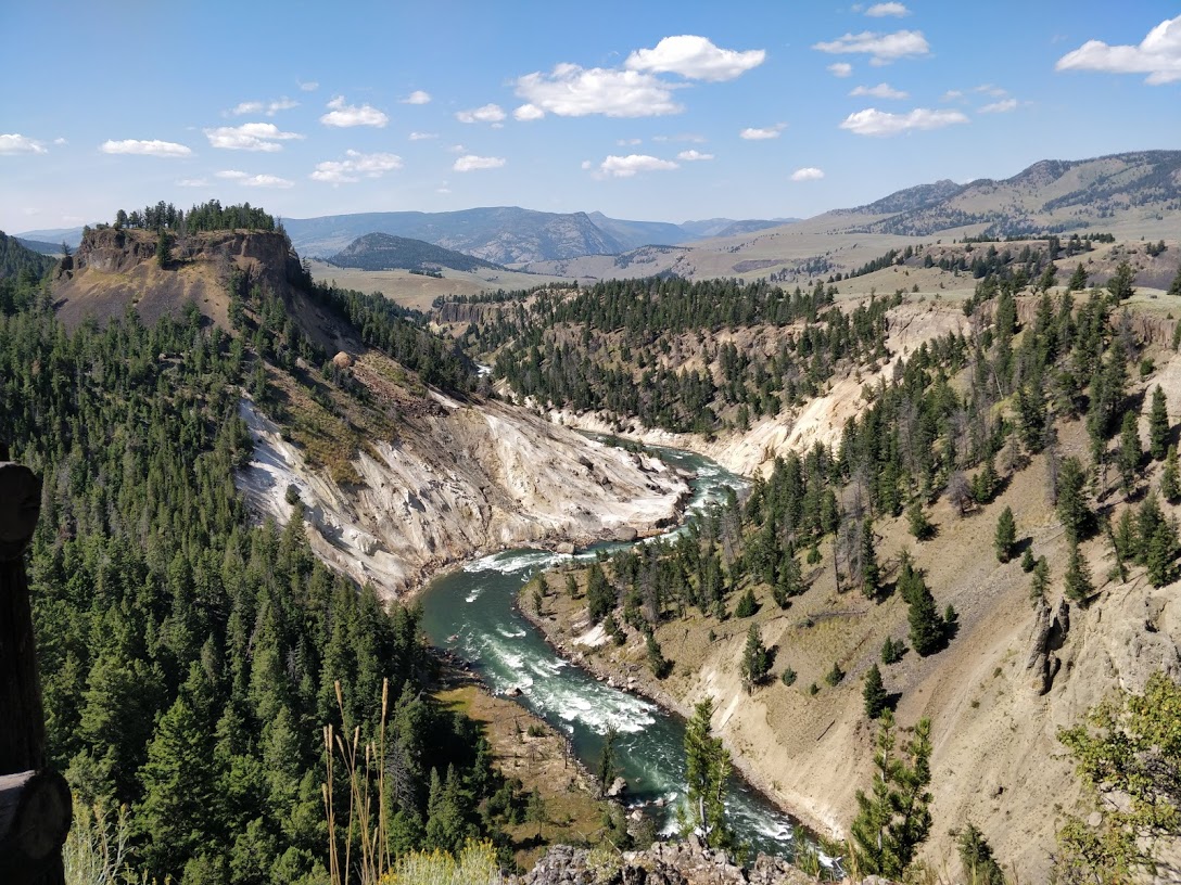
Upriver of the fall, we stopped at a lookout point. This spot was at the other end of Grand Canyon of the Yellowstone, which we visited a few days ago. The canyon had the same characteristic yellow/orange walls caused by the rhyolite rock becoming geothermally altered. We also spotted a coyote across the river!
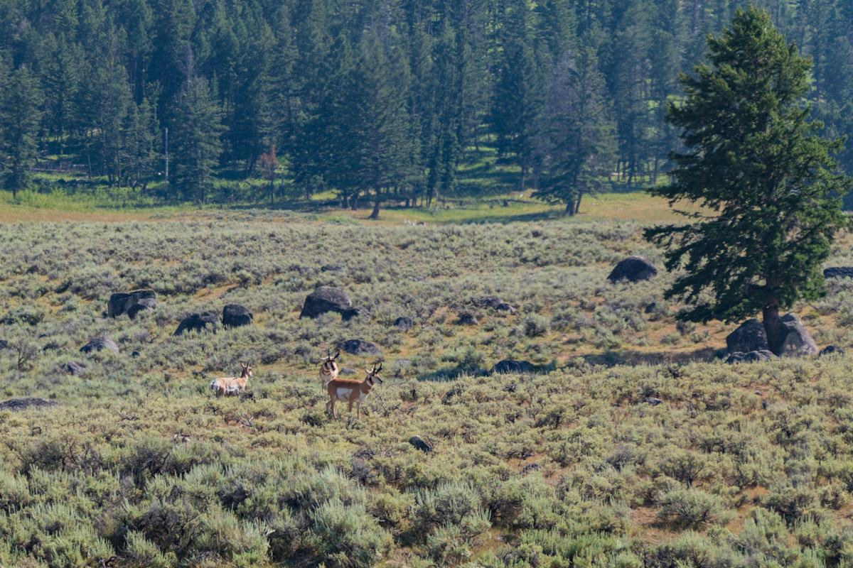
Lamar Valley
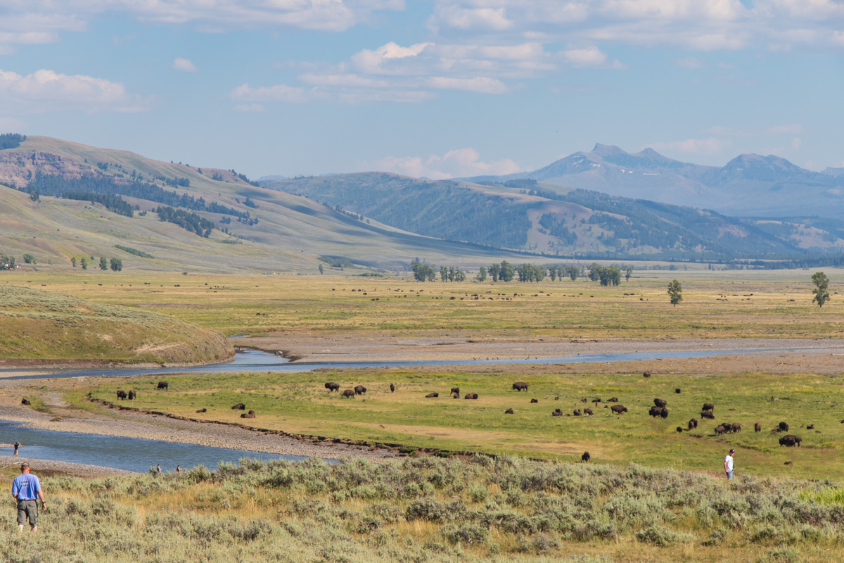
When we finally reached the Lamar Valley, forests gave way to rolling meadows of Kentucky bluegrass - which the bison love. Bison were hunted to near extinction in Yellowstone by the late 1880's, but luckily the National Park Service has worked to reintroduce bison over the last 50 years. Their efforts have been so successful that they are now facing the challenge of having too many bison in the park!
We spotted a bear-jam (that is, a traffic jam caused by a bear sighting) on the road out of the Lamar Valley, and pulled over. We struggled to spot the bear and it's cub, until a family next to us offered their binoculars. We had seen heaps of people with scopes and binoculars in the park, but had not really understood why, until now!
Petrified Tree
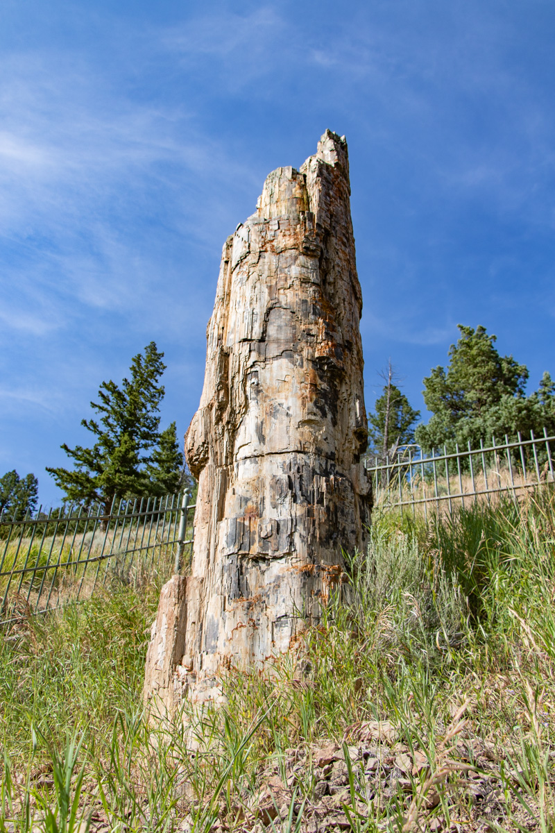
As we pulled into the carpark and spotted a lone fenced tree stump, I couldn't help thinking, a bit disappointed, "is that it?" However, upon closer inspection, it proved much more interesting!
Volcanic flow buried the forest 50 million years ago. The silica in the volcanic flow plugged the living cells of the tree, petrifying it, turning it to stone! What is even more impressive is that it is a redwood tree, the same as those found in California today! Perhaps an indicator that Yellowstone was once much wetter and warmer?! Cool!